THINGS TO DO
IN AND AROUND JULIAN
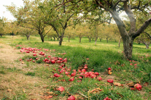
Apple Days – mid September through mid-October (or when apples are gone.)
California Wolf Center: Programs include an educational presentation and guided observation of resident wolves. Tours run an hour and a half and are by appointment only. Children under 18 must be accompanied by an adult. (760) 765-0030, P.O. Box 1389, Julian, CA 92036, www.californiawolfcenter.org
Eagle And High Peak Mine: Tour one of Julian's original gold mines. Guides lead you through the intricate path of tunnels in the hard rock mine and share tales of the life of early residents of Julian. Call for hours of operation. (760) 765-0036, End of C Street, P.O. Box 624, Julian, CA 92036
Every Sunday: Julian Doves & Desperados – historic comedy skits at 1 p.m., 2 p.m. & 3 p.m. – stage area between Cabbages & Kings and the Julian Market & Deli.
Every Sunday: Music at the Market -- live music and barbeque at the patio starting at 12 noon. Wine, beer & hard cider tasting inside at 4470 Julian Rd.(Hwy. 78), at the Wynola Farms Marketplace, 3 miles West of Main St., www.wynolafarms.com
Julian Mining Company: Discover gold & minerals using gold pans, sluice box and 'rockers.' Hayrides, U-Press cider, gift shop, raspberry picking & pumpkin patch in fall. (951) 313-0166, Email: [email protected], www.julianminingcompany.com
Saturday Evenings: Santa Ysabel Casino Live Music – 8 p.m. to 12 a.m., country, blues and classic rock bands – (760) 787-0909, 25575 Highway 79, Santa Ysabel, www.santaysabelcasino.com
Smith Ranch Train and Gold Mine Tours: Enjoy a 1-mile train ride, explore the 1870 Smith Ranch gold rush mine and pan for gold. Monday thru Saturday at 10, 11:30, 1 and 2:30. (760) 765-2288, www.pioneerways.com
Town Hall Crafters Arts & Crafts Show – 9 a.m. to 5 p.m. – Town Hall
HIKING TRAILS
Hikes within William Heise County Park
Tel: (858) 565-3600 Web: www.co.san-diego.ca.us/parks
Self-Guided Nature Trail - Easy, half mile loop.
Canyon Oak Trail - is 1.25 miles that connects to the Desert View Trail.
Desert View Trail - 2.25 miles with a panoramic scenic overlook.
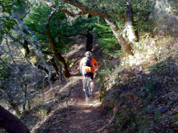
Kelly Ditch Trail - 5.75 miles, is great for walking or riding horses. Trail connects the park with Cuyamaca Rancho State Park and Lake Cuyamaca.
Hikes within Cuyamaca Rancho State Park
Tel: (760) 765-0755; (800) 444-7275,
Select hiking trails and day use are currently open at the Green Valley Campground. Updated trail maps and information are available at Paso Picacho and Green Valley Kiosks, 8 a.m. to 4 p.m. daily. The popular Stonewall Peak Trail is only open on weekends. Web: http://www.stateparks.com/cuyamaca.html
Paseo Nature Trail - Easy .5 mile loop, scenic, level, and suitable for children. Self-guiding trail with 16 trail signs explaining various natural and cultural resources of the area. Trailhead and parking at north end of picnic area at Paso Picacho campground.
Indian Trail - Easy one mile level, scenic, and suitable for children. Self-guiding trail leading to an old Indian village site, plaques describe Indian uses for common plants. Trail head and parking by the flagpole at the park headquarters/museum parking lot.
Green Valley Falls Trail - Easy .75 mile one way, suitable for children. Well-marked trail to pretty, seasonal waterfall. Best in spring and early summer. Trailhead and parking located at picnic area parking lot at Green Valley Campground.
Azalea Glen Loop Trail - Moderate 4-mil! e loop, gain in elevation 550 ft. Mostly shaded in summer, sheltered in winter. Walk along one of the few year-round streams in this park. Trail head and parking at Paso Picacho campground parking lot.
Juaquapin Trail - Moderate 3 mile scenic loop climbing via East Site Trail with a steepish return by Dyar Spring Trail. Gain in elevation 400 ft. Well-graded trail through oaks, manzanita, chaparral and open meadows and stream with wildflowers and deer. Trail head and parking at turnoff for Museum/Park headquarters or a Sweetwater Bridge.
Conejo Spring Trail - Moderately strenuous 3.5 sometimes steep miles to summit. Gain in elevation 1650 ft. Rugged ascent over the north shoulder of Cuyamaca Peak. Trail is a streambed after heavy rain or snow melt. Connects to paved road leading to summit. Descent to campground by paved fire road. Trail head and parking at Pasa Picacho Campground.
Stonewall Peak Trail - Moderate 2 miles each way, steady gain in elevation of 900 ft. Suitable for energetic youngsters. Well graded trail through chaparral, oaks and incense cedar to the summit of Stonewall Peak, last section on exposed ridge but with steps and handrail. Great views from peak. Trail head and parking across from entrance to Pasa Picacho campground at the picnic area. Day use fee.
Oakzanita Peak Trail - Moderately strenuous 8 mile loop, gain in elevation 1300 ft. Long steady climb leads to extensive vistas particularly from the peak. Trail has little shade and is hot in the summer. Trail head and parking - first paved parking area when entering Cuyamaca Park from the South on Highway 79. Moderately strenuous 5 mile loop. Gain in elevation 1200 ft. Steady climb leads to extensive vistas, first to the coastline and later over East Mesa. The hike follows the fire road to Arroyo Seco primitive camp, then by cut-off trail to West Mesa Trail and Monument Trail.
Hikes within William Heise County Park
Tel: (858) 565-3600 Web: www.co.san-diego.ca.us/parks
Self-Guided Nature Trail - Easy, half mile loop.
Canyon Oak Trail - is 1.25 miles that connects to the Desert View Trail.
Desert View Trail - 2.25 miles with a panoramic scenic overlook.
Kelly Ditch Trail - 5.75 miles, is great for walking or riding horses. Trail connects the park with Cuyamaca Rancho State Park and Lake Cuyamaca.
Hikes within Cuyamaca Rancho State Park
Tel: (760) 765-0755; (800) 444-7275,
Select hiking trails and day use are currently open at the Green Valley Campground. Updated trail maps and information are available at Paso Picacho and Green Valley Kiosks, 8 a.m. to 4 p.m. daily. The popular Stonewall Peak Trail is only open on weekends. Web: http://www.stateparks.com/cuyamaca.html
Paseo Nature Trail - Easy .5 mile loop, scenic, level, and suitable for children. Self-guiding trail with 16 trail signs explaining various natural and cultural resources of the area. Trailhead and parking at north end of picnic area at Paso Picacho campground.
Indian Trail - Easy one mile level, scenic, and suitable for children. Self-guiding trail leading to an old Indian village site, plaques describe Indian uses for common plants. Trail head and parking by the flagpole at the park headquarters/museum parking lot.
Green Valley Falls Trail - Easy .75 mile one way, suitable for children. Well-marked trail to pretty, seasonal waterfall. Best in spring and early summer. Trailhead and parking located at picnic area parking lot at Green Valley Campground.
Azalea Glen Loop Trail - Moderate 4-mil! e loop, gain in elevation 550 ft. Mostly shaded in summer, sheltered in winter. Walk along one of the few year-round streams in this park. Trail head and parking at Paso Picacho campground parking lot.
Juaquapin Trail - Moderate 3 mile scenic loop climbing via East Site Trail with a steepish return by Dyar Spring Trail. Gain in elevation 400 ft. Well-graded trail through oaks, manzanita, chaparral and open meadows and stream with wildflowers and deer. Trail head and parking at turnoff for Museum/Park headquarters or a Sweetwater Bridge.
Conejo Spring Trail - Moderately strenuous 3.5 sometimes steep miles to summit. Gain in elevation 1650 ft. Rugged ascent over the north shoulder of Cuyamaca Peak. Trail is a streambed after heavy rain or snow melt. Connects to paved road leading to summit. Descent to campground by paved fire road. Trail head and parking at Pasa Picacho Campground.
Stonewall Peak Trail - Moderate 2 miles each way, steady gain in elevation of 900 ft. Suitable for energetic youngsters. Well graded trail through chaparral, oaks and incense cedar to the summit of Stonewall Peak, last section on exposed ridge but with steps and handrail. Great views from peak. Trail head and parking across from entrance to Pasa Picacho campground at the picnic area. Day use fee.
Oakzanita Peak Trail - Moderately strenuous 8 mile loop, gain in elevation 1300 ft. Long steady climb leads to extensive vistas particularly from the peak. Trail has little shade and is hot in the summer. Trail head and parking - first paved parking area when entering Cuyamaca Park from the South on Highway 79. Moderately strenuous 5 mile loop. Gain in elevation 1200 ft. Steady climb leads to extensive vistas, first to the coastline and later over East Mesa. The hike follows the fire road to Arroyo Seco primitive camp, then by cut-off trail to West Mesa Trail and Monument Trail.
